×
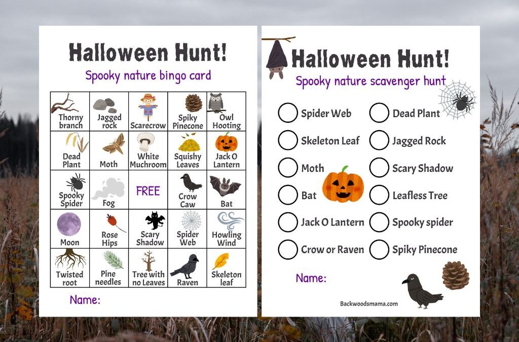
Halloween Nature Scavenger Hunt & Bingo (Free Printables!)
Halloween is here, along with all the spooky, magical things happening in nature as fall deepens. Spiders creep into cozy corners, webs glisten...


Yellow Lake is located 14 km west on Highway 3A from the Okanagan Highway 97 junction near Kaleden, BC. It is 27 km south-west from Penticton and 20km north-west from Okanagan Falls, BC. The lake is a good spot for shore fishing and is well stocked with trout making it a great spot to fish with children. There is also a large parking area on the west side of the lake with picnic tables, flush toilets and running water (not drinkable).
The hike from Yellow Lake is well described in Sweet Singletrack, a comprehensive database of trails in the Central and South Okanagan valley. I would recommend paying the $10 yearly fee to have access to this database, especially if you are local and enjoy hiking. We printed a copy of the trail description from the Sweet Singletrack database, and felt grateful for it at the outset. The trail begins on the west side of the lake through an unlocked gate, just left of the picnic tables. On the other side of the metal gate the trail is overgrown with prickly rosebushes and stinging nettle (OUCH!) and drops down into a marshy area. Continue downward and carefully walk across the slippery rocky marsh and up to the other side. Up ahead near the lakeshore, with the lake on your left hand side, the forest opens and the trail continues steeply up the hill.
The steep trail is narrow and sometimes overgrown with brush. I highly recommend wearing pants, especially to ward of the surprising agony that comes with brushing up against stinging nettle. Overall, however, we found that the trail was well marked with flagging tape and cairns (rock piles). Apparently the trail becomes more confusing further along when it intersects an old two-track road.
While this might seem like a short day hike (9 km, return) it is consistently steep and not easy for young children. We did not manage to complete the entire hike. After hiking 1.5 km and gaining more than 400 m in elevation we chose to return. We managed to hike nearly to the point where the trail intersects with a two-track road. My brother-in-law went up a bit further to confirm this only to return after encountering a baby bear. Sometimes it can difficult to turn back early but we had a late start, and it was a difficult climb for my younger children. Here is a link to our route. That being said this is a beautiful area to hike through and I can only imagine the view from the peak. We hope to return again to complete this hike one day, maybe in a year when my children are a little older.
Halloween is here, along with all the spooky, magical things happening in nature as fall deepens. Spiders creep into cozy corners, webs glisten...
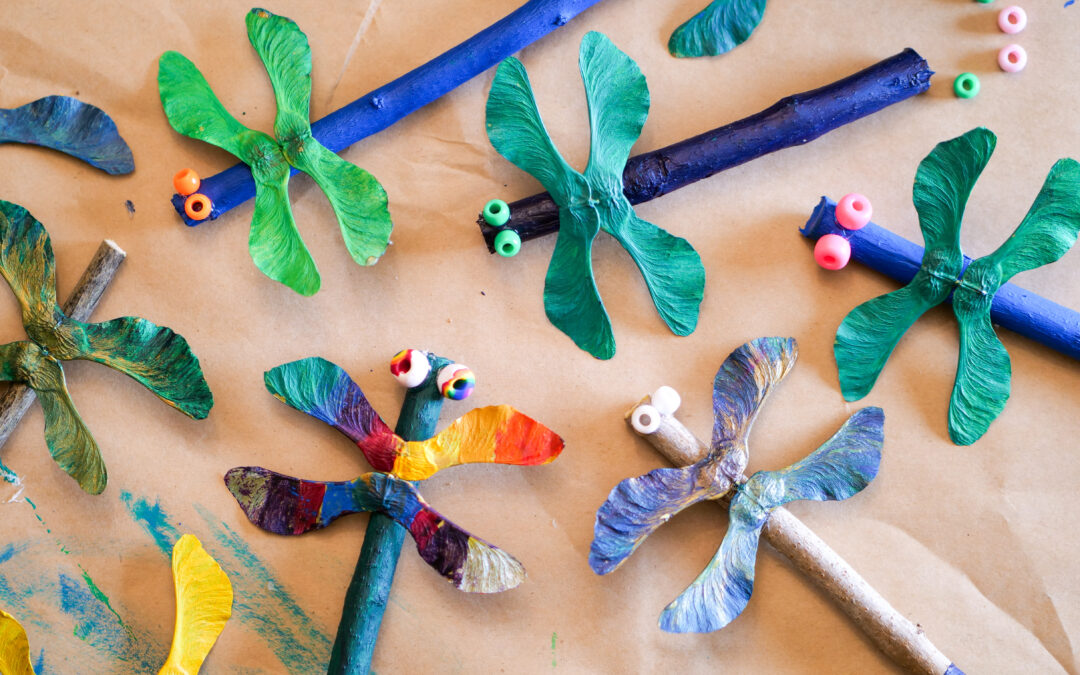
Maple Seed Dragonfly Nature Craft From spring well into fall, maple trees are bejeweled with curious winged seeds. Botanically, they’re called...

Hello, October! The light turns honey-gold, leaves crunch underfoot, and the air smells like rain and woodsmoke. October invites us to lean into...
0 Comments